
{SWW Event 2017/13.7}
NOT TO BE BROADCAST AFTER 09:00pm Wednesday 05-Apr-2017
SEVERE WEATHER WARNING.
ISSUED BY MetService AT 10:01am 05-Apr-2017
URGENT – IMMEDIATE BROADCAST IN: Northland, Auckland, Great Barrier
Island, Waikato, Waitomo, Coromandel Peninsula, Bay Of Plenty,
Rotorua, Taranaki, Wanganui, Taumarunui, Taupo, Hawkes Bay, Tararua,
Wairarapa, Manawatu, Kapiti Horowhenua, Wellington, Marlborough,
Nelson, Buller, Christchurch, Gisborne
HEAVY RAIN FOR MANY PARTS OF THE NORTH ISLAND AND THE UPPER SOUTH
ISLAND, AND STRONG WINDS ACROSS CENTRAL NEW ZEALAND
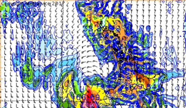
A deepening low over the Tasman Sea is forecast to cross central New
Zealand overnight Wednesday and early Thursday morning and move away
to the southeast later Thursday. Heavy rain has already fallen in
many places and is expected to continue until the passage of the low
early Thursday morning. The heaviest rain is expected from Northland
to Whanganui, including Coromandel Peninsula, Bay of Plenty, the
Central North Island High Country, Gisborne, Hawkes Bay,Wairarapa and
the Kaikoura Coast. There is also potential for thunderstorms and
downpours with hourly rainfall rates of 25 to 45mm.
People are advised to watch out for rapidly rising rivers and
streams, flooding and slips.
In addition, strong southeasterly winds are forecast about central
New Zealand. Horowhenua Kapiti Coast, Nelson and Buller are expected
to have the strongest winds, where gusts could reach 120 km/h in
exposed places for a time during Wednesday.
Also, southwest gales are expected over Banks Peninsula and the
Kaikoura Coast from Thursday morning to Thursday night, with gusts of
140km/h in exposed places. Winds of this strength could cause damage
to trees, powerlines and unsecured structures and make driving
hazardous.
FOR THE LATEST WEATHER AND FORECAST CHARTS PLEASE GO TO
http://metservice.com
MORE DETAILED INFORMATION FOR EMERGENCY MANAGERS AND TECHNICAL USERS
FOLLOWS.
======================
HEAVY RAIN WARNING
======================
AREA/S AFFECTED: WAIKATO AND WAITOMO FORECAST:
Further periods of heavy rain are expected until tonight. In the 12
hours from about midday today a further 90 to 120mm may accumulate.
Peak intensities 25 to 45mm per hour and thunderstorms possible.