
Also check these pages:
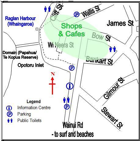
Raglan Street Map
Parking is usually available in the streets around the Shops & Cafes area. There is a car park next to the Fire Station in Wainui Road, just south of the Bankart St roundabout. The Raglan Club in Bow St also has a large car park next to and behind the Club.
Click on the maps above for a larger view.
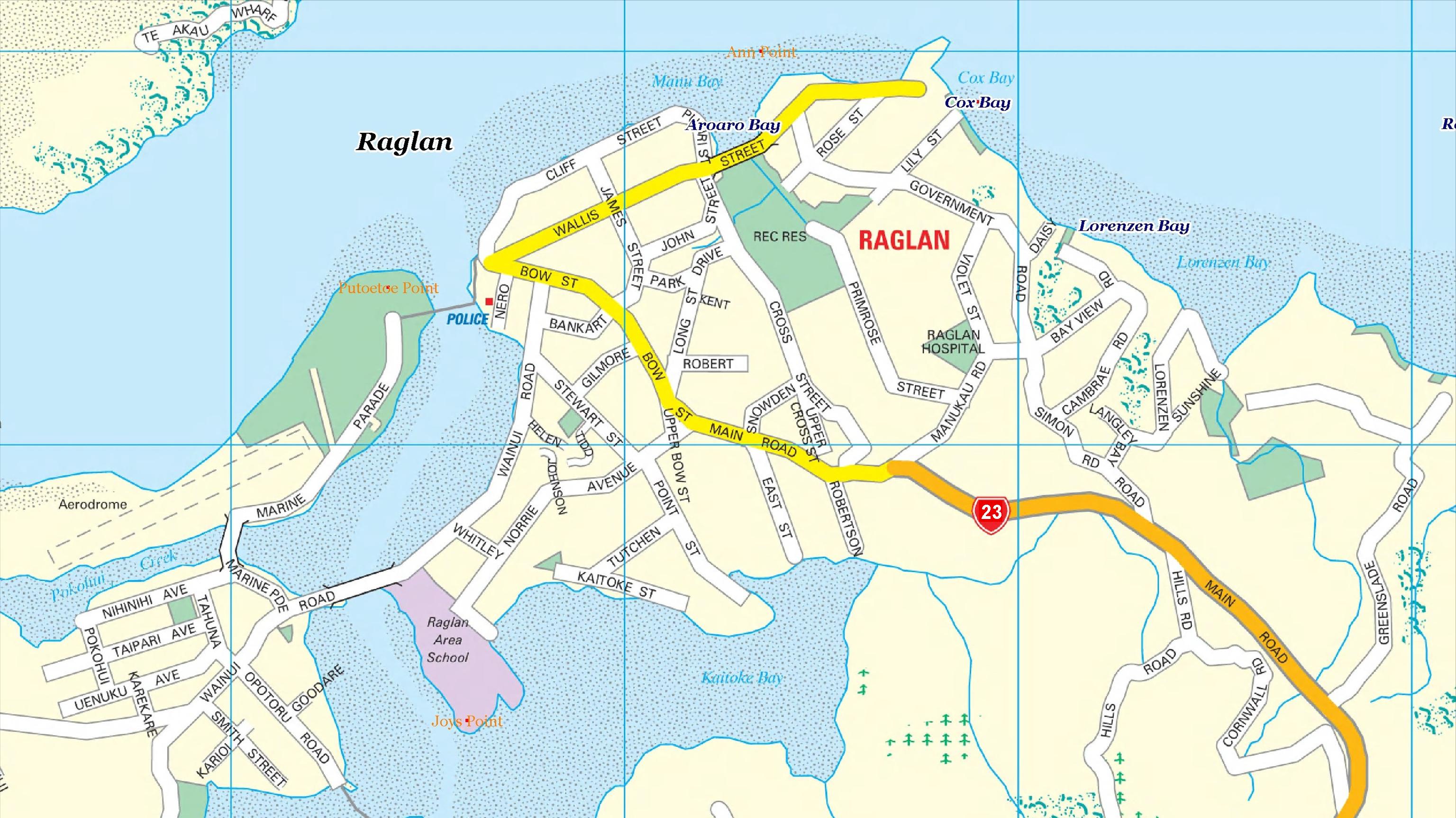
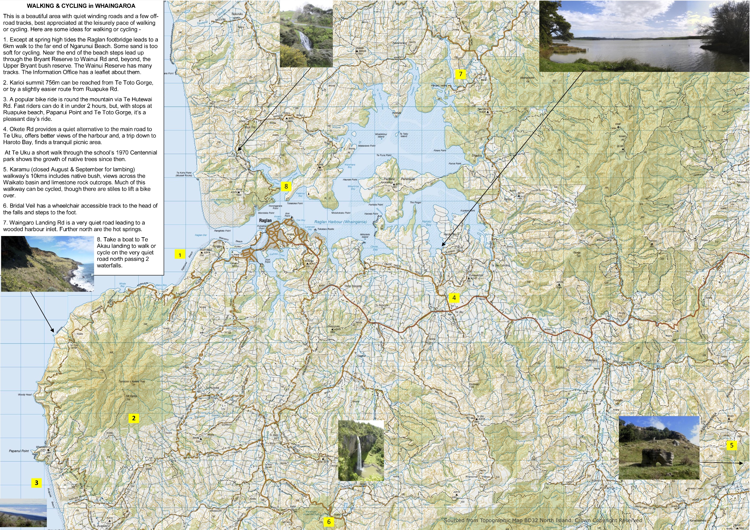
Raglan Walking and Cycling Map
Whaingaroa Environmental Defence has produced a walking and cycling map for Raglan Whaingaroa as shown below. This is the best and most up-to-date street map available for Raglan.

Click on the maps above for a larger view.
The maps are also available for download as PDF files. Click here to download Map 1 (Raglan Town) and Click here to download Map 2 (Raglan Area)
Detailed Walking Maps
For more detailed walking maps of New Zealand including Raglan Whaingaroa, check out the Walking Access Maps www.wams.org.nz
Approach roads to Raglan
[SGM lat=”-37.8″ lng=”175.0100000″ zoom=”11″ type=”ROADMAP”]
Raglan’s Geology
For a great map on Raglan’s Geology check out http://ndhadeliver.natlib.govt.nz/content-aggregator/getIEs?system=ilsdb&id=296686
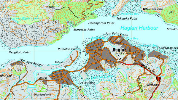
Raglan’s Geographical Features
And to take a look at geographical features around Raglan check out
https://data.linz.govt.nz/x/KHm2g6
Add a ‘layer’ to look at the features you want.
where is the closest pet quarantine facility to Raglan? please be
specific with driving time, etc.
thank you!!!!
It is Qualified Pet Services, which is at Takanini – the southern side of Auckland. It is about two hours north of Raglan by car. Follow the instructions on our Getting To Raglan page
Take SH1 North to Auckland and leave the motorway at Takanini which is North of Papakua. The ‘Airflield Rd’ referred to in the address below is close to Ardmore Airport.
Their website is http://www.qualifiedpet.co.nz/
The address is:
150 Airfield Road
Takanini, Auckland
New Zealand
Postcode 2582
Contact details are:
Phone: 64 9 299-9539
Fax: 64 9 299-9539
E-Mail: services@qualifiedpet.co.nz