
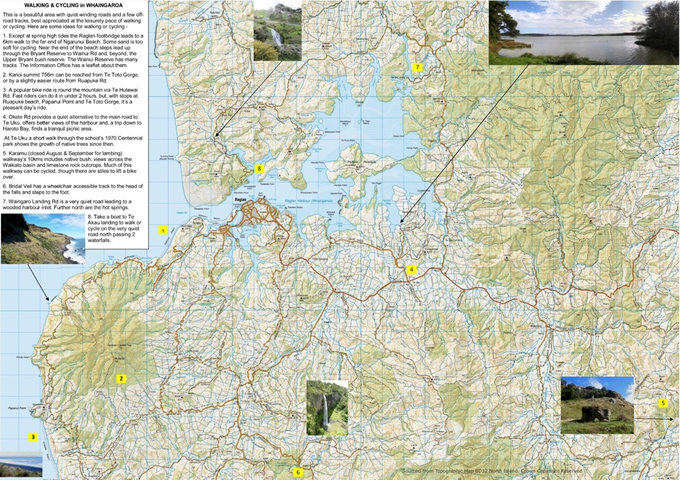
A new map of Raglan and Whaingaroa aims to encourage us to walk and cycle more. Waikato District Council has funded Whaingaroa Environmental Defence (WED) to produce a double sided A3 leaflet for every Raglan letterbox, with copies also available at the Information Centre and Cyclery Raglan. It includes maps, photos and suggested routes. As the most up to date map of Raglan with an index of streets and showing little known paths, WED hopes it will find its way onto many walls and fridges around Whaingaroa as a handy reference and a reminder that most of our journeys are short enough to walk, or cycle.
The map shows estimates of the time it takes to walk and cycle to and from the CBD; it takes under ten minutes to cycle to the CBD from most of Raglan. Transport produces 42% of New Zealand’s carbon emissions, cycling and walking are healthy and CBD car parking is often a problem. For these reasons WED and the Council hope the map will get more people discovering the joys of walking and cycling.